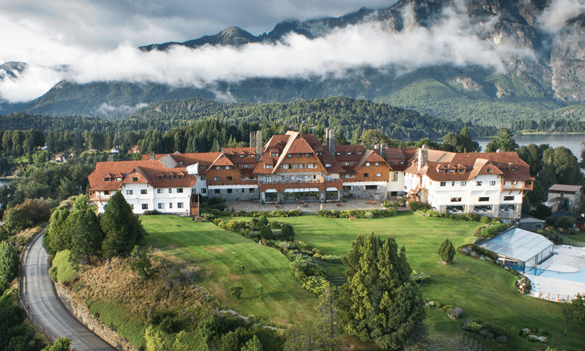
Llao Llao Hotel
15 min drive
This historic hotel offers architectural interest and access to the Llao Llao Municipal Park trails.

Cerro Campanario sits at kilometer 17.5 of the Circuito Chico loop, a modest summit that commands the widest single vista in the Patagonian lakes district. The viewing platform opens daily from 09:00 to 18:00, accessible by a 20-minute forest trail or a six-minute chairlift. Most visitors arrive mid-loop during the scenic drive around Península San Pedro.
Quick answer
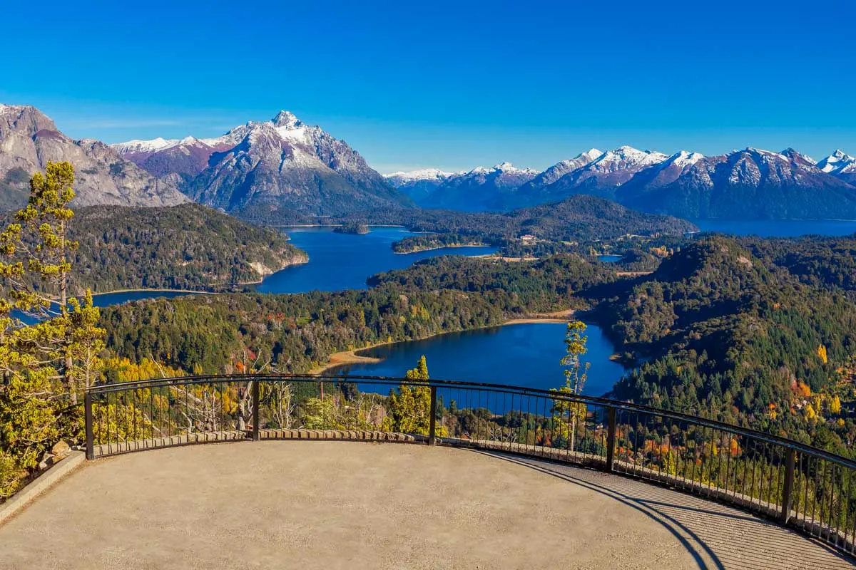
Cerro Campanario opens 09:00–18:00 every day at Avenida Exequiel Bustillo km 17.5, with free entry for hikers and a separate chairlift fee. The optimal arrival window is 09:00–10:30, before tour buses from central Bariloche fill the parking area. The summit viewing deck overlooks Lago Nahuel Huapi, Península San Pedro, Lago Moreno, and the Andes cordillera framing the western horizon.
Cerro Campanario rises 1,050 meters above sea level, but only 110 vertical meters separate the trailhead from the circular observation deck at the summit. That modest climb delivers what National Geographic Traveler once called one of the continent's finest panoramas: the entire Nahuel Huapi basin spreads below, with Isla Victoria, Península Llao Llao, and the twin Moreno lakes framed by the serrated peaks of Tronador and Catedral. The circuito chico bariloche mapa places Campanario at the halfway mark of the 60-kilometer loop, making it the logical orientation point for first-time visitors trying to parse the geography of braided lakes, forested peninsulas, and volcanic summits. The trail begins behind the chairlift station at kilometer 17.5 of Avenida Exequiel Bustillo, the two-lane paved route that traces the northern shore of Nahuel Huapi. Wooden steps and packed-earth switchbacks climb through a dense coihue and arrayán forest, dappled with lichen and Chilean bamboo. The grade is steady but never steep; most hikers reach the top in 18 to 22 minutes. A six-minute chairlift runs parallel to the trail for visitors who prefer to save their knees or arrive before the sun clears the eastern ridgeline. Both routes converge at the same circular platform, a stone-and-timber deck cantilevered over the drop. The view from the summit is the reason this hill appears on every Bariloche scenic circuit map. To the west, the Andes rise in three distinct ranges, their snowfields glowing pink at sunrise and violet at dusk. Directly below, Península San Pedro juts into Nahuel Huapi, its northern shore dotted with cypresses and holiday cabins. Lago Moreno Oeste and Lago Moreno Este lie to the south, separated by a narrow forested isthmus that carries the Circuito Chico road. On clear days, the granite spires of Cerro Tronador are visible 40 kilometers to the southwest, and the ski runs of Cerro Catedral stripe the eastern horizon. The platform includes labeled orientation panels that decode the layered topography, essential for visitors attempting to match what they see with the route they drove. Timing the visit determines the experience. Early-morning light strikes the western peaks first, casting long shadows across the water and turning the lakes cobalt. By 10:30, tour groups from Puerto Pañuelo and Llao Llao begin arriving, and the platform fills quickly; photographers lose clean sightlines, and the trail becomes a two-way bottleneck. Late afternoon offers softer light and thinner crowds, though winter visitors should note that the sun drops behind Cerro López by 16:00, plunging the deck into shadow an hour before closing. The chairlift operates on the same 09:00–18:00 schedule as the site itself, with no night access or after-hours viewing. Parking occupies a gravel lot at the base of the chairlift, with space for roughly 30 vehicles. Overflow parking lines the shoulder of Bustillo, legal but inconvenient during the January-February peak. No on-site food service exists beyond a small kiosk selling bottled water and packaged snacks; the nearest café sits 2.5 kilometers east at Playa Bonita. Restrooms are located adjacent to the chairlift boarding area. The summit platform itself is exposed, with no windbreak or shelter; layered clothing and sunscreen are necessary year-round, as the wind off Nahuel Huapi accelerates over the ridgeline. Cerro Campanario functions as both a standalone destination and a calibration point for the broader circuito chico bariloche mapa. Visitors who complete the loop will pass Bahía López, Puerto Pañuelo, Punto Panorámico, and Playa Bonita, but none of those stops offer the vertical perspective that makes sense of the route's winding geometry. The summit view stitches the circuit together, transforming a sequence of lake-level vignettes into a legible topographic system.
“The summit platform decodes the layered topography of Nahuel Huapi, transforming a sequence of lake-level vignettes into a legible geographic system.”
The optimal time to visit Cerro Campanario is during the arrival window of 09:00–10:30. This strategy allows you to experience the summit before the arrival of mid-day tour groups and ensures easier access to parking facilities.
Warm, 15°C to 25°C. Sunny days are common.
Expect the largest crowds during these months. Arrive early to secure parking.
Cool, 5°C to 15°C. Frequent crisp air.
This season offers clear visibility and fewer tour buses. Ideal for photography.
Cold, -2°C to 8°C. Snow is frequent.
Conditions are often snowy, which may impact footpaths. Verify mountain status before departure.
—
Arriving at 09:00 significantly reduces wait times at the base. This remains the most efficient way to navigate the site.
Verdict: Plan your visit for a weekday morning between 09:00 and 10:30 during the months of April or October for the best balance of manageable crowds and stable weather.
Cerro Campanario operates on a consistent daily schedule throughout the week to accommodate visitors exploring the Circuito Chico area.
Access to Cerro Campanario is determined by your chosen method of ascent. While hiking the trail is open to the public, the chairlift operates as a separate service requiring a fee.
Verdict: Visitors who choose to hike the trail pay 0 ARS, while those opting for the chairlift must purchase a ticket at the base.
Cerro Campanario is located at Av. Exequiel Bustillo km 17.5. It is accessible via the main Circuito Chico route from San Carlos de Bariloche city center.
Line 20 (Mi Bus) from Bariloche center to stop at km 17.5
Drive west on Av. Exequiel Bustillo (RP 77) until km 17.5
Direct service from Bariloche center to Cerro Campanario base
Plan to arrive between 09:00 and 10:30 to secure parking and avoid the mid-day arrival of large tour groups.
Cerro Campanario sits at the heart of the Circuito Chico, making it an ideal anchor for exploring surrounding landmarks. These stops provide diverse perspectives of the Nahuel Huapi landscape along the route.
15 min drive
This historic hotel offers architectural interest and access to the Llao Llao Municipal Park trails.
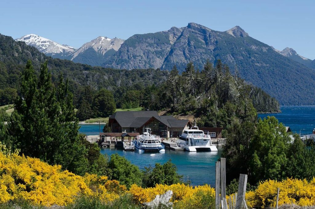
15 min drive
Located near the hotel, this is the primary departure point for lake excursions toward Victoria Island.
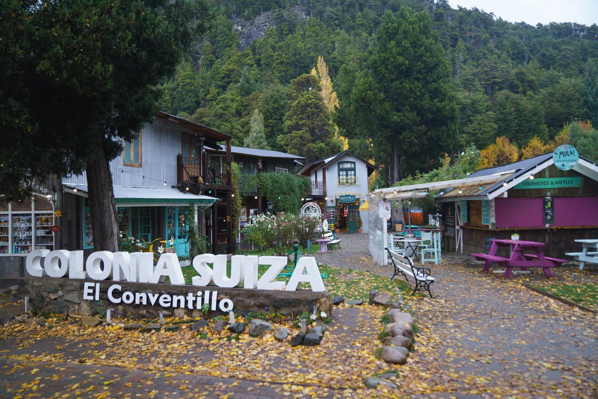
20 min drive
A traditional settlement known for its heritage architecture and regional cuisine, located just off the main circuit.
25 min drive
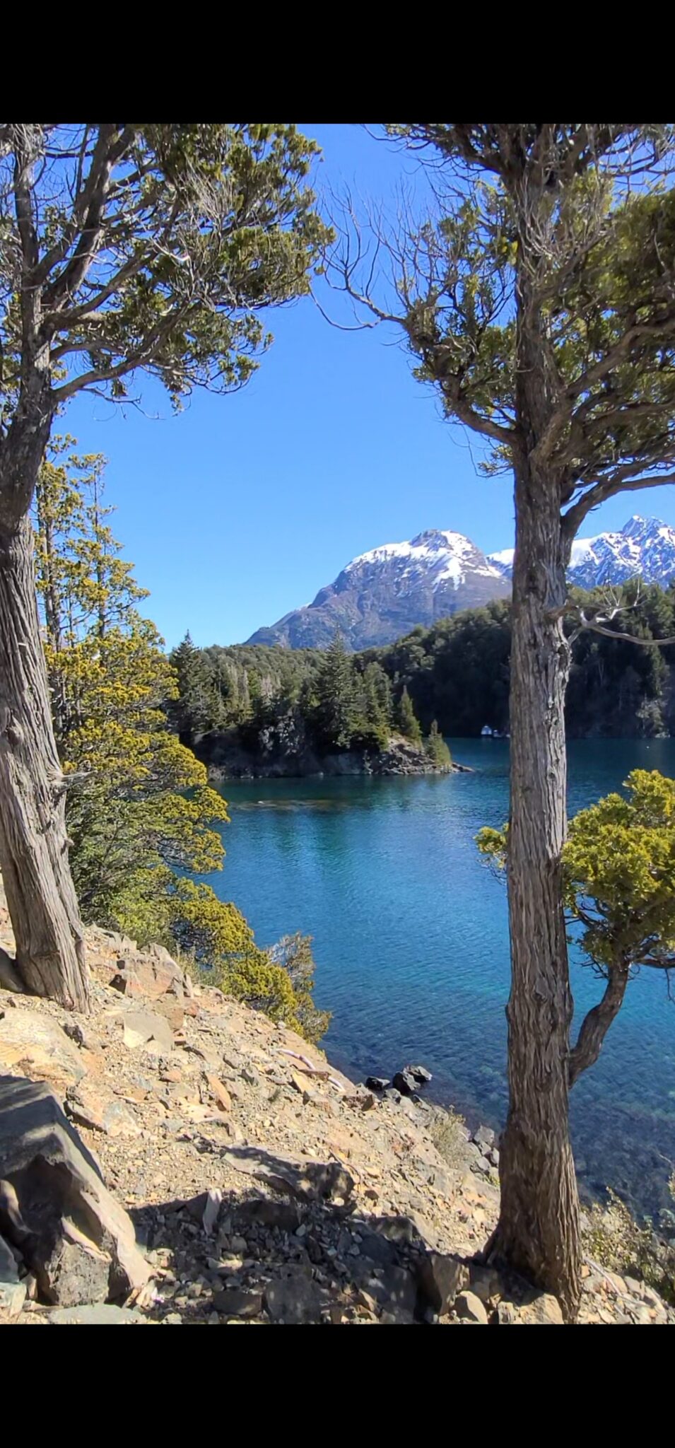
This area features accessible beaches and forest trails that complement the elevated views from the hill.
Everything you need to know about circuito chico bariloche mapa
Yes, Cerro Campanario is a primary highlight located along the main route featured on any circuito chico bariloche mapa. It is centrally located along Avenida Exequiel Bustillo, making it an essential stop for those touring the region.
While accessing the trail for hikers is free, the chairlift service requires a separate fee. You can find detailed information regarding these logistics in the pricing section of this guide.
You can easily reach the base via local bus lines or rental car by following the coastal road indicated on your circuito chico bariloche mapa. The address is Av. Exequiel Bustillo km 17.5, which serves as a central landmark for navigation.
The best arrival window is between 09:00 and 10:30. Arriving during this time helps you avoid mid-day tour group crowds and ensures you secure better parking.
Hikers may access the mountain trails with an entry fee of 0 ARS. Please note that this only applies to the footpaths, as the mechanical lift operates under a different cost structure.
A clear circuito chico bariloche mapa assists in identifying the sequence of viewpoints, lakes, and forests nearby. It allows travelers to balance their time at the summit with other attractions along the scenic loop.